Trip Overview:
Arrive at Virginia Lakes Pack Outfit by 7:00 AM where your gear will be weighed and you will be served breakfast. Your personal vehicles will be left in the pack station parking area.
Begin at Virginia Lakes; Ending at Tuolumne Meadows.
You will leave from the pack station. A pack station driver will pick you up at the Tuolumne Meadows Stable parking area located west of Lembert Dome, returning you to the Virginia Lakes Pack Outfit station.
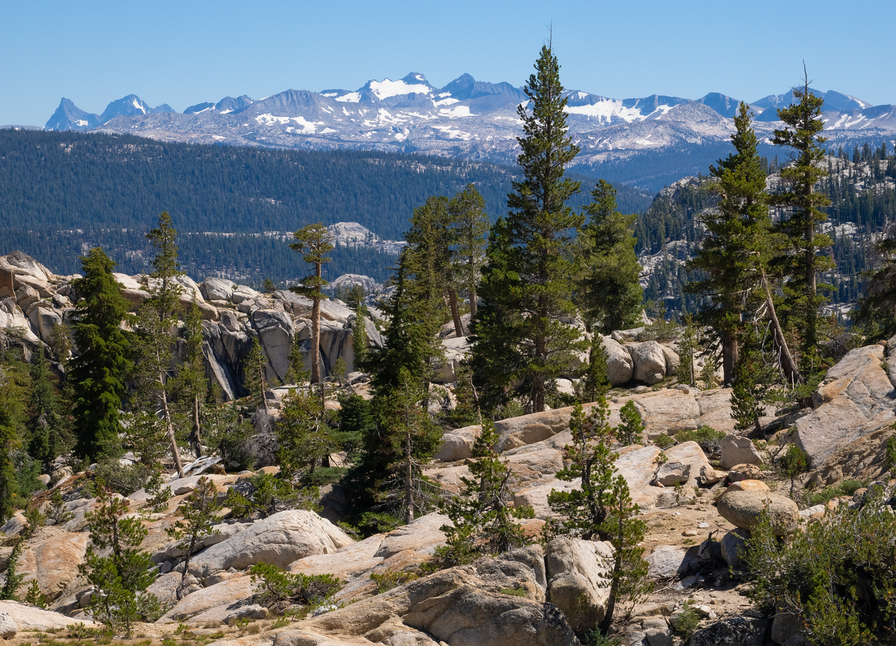
Experience a section of Yosemite National Park that few visitors see. You will enter Yosemite from the east side of the Sierra, at Virginia Lakes, to cross the Sierra Crest into Yosemite National Park. Your path will lead you past expansive views, powerful waterfalls, cascading creeks, dense pine forests, and lush meadows as you travel through the granite peaks and glacial valleys of northern Yosemite.
All you need to bring is a sturdy duffel with your
clothing, toiletries, sleeping bag, and pad. We will take
care of the rest.
Layover day allows day trips to Miller Lake, McCabe Lakes, and Waterwheel Falls.
To learn about the forest, wildlife, geology and much more look at
the Yosemite National Park website. Select Learn About the Park>Nature> and then the topics you are interested in to learn more.
Itinerary:
If you are a hiker, you should be able to walk ten miles, 1,500 elevation gain and 2,500 loss. You should acclimate to 8,000 to 10,000 for 1-3 days prior to the trip.
Distance: approximately 25 miles, 3,400 feet total gain and 4,550 feet loss on moving days.
Elevation Profile:

This trip passes many lakes and creeks, so available drinking water is not a problem in normal water conditions. Be prepared for creek crossings. Most of the crossings can be made on rocks or logs
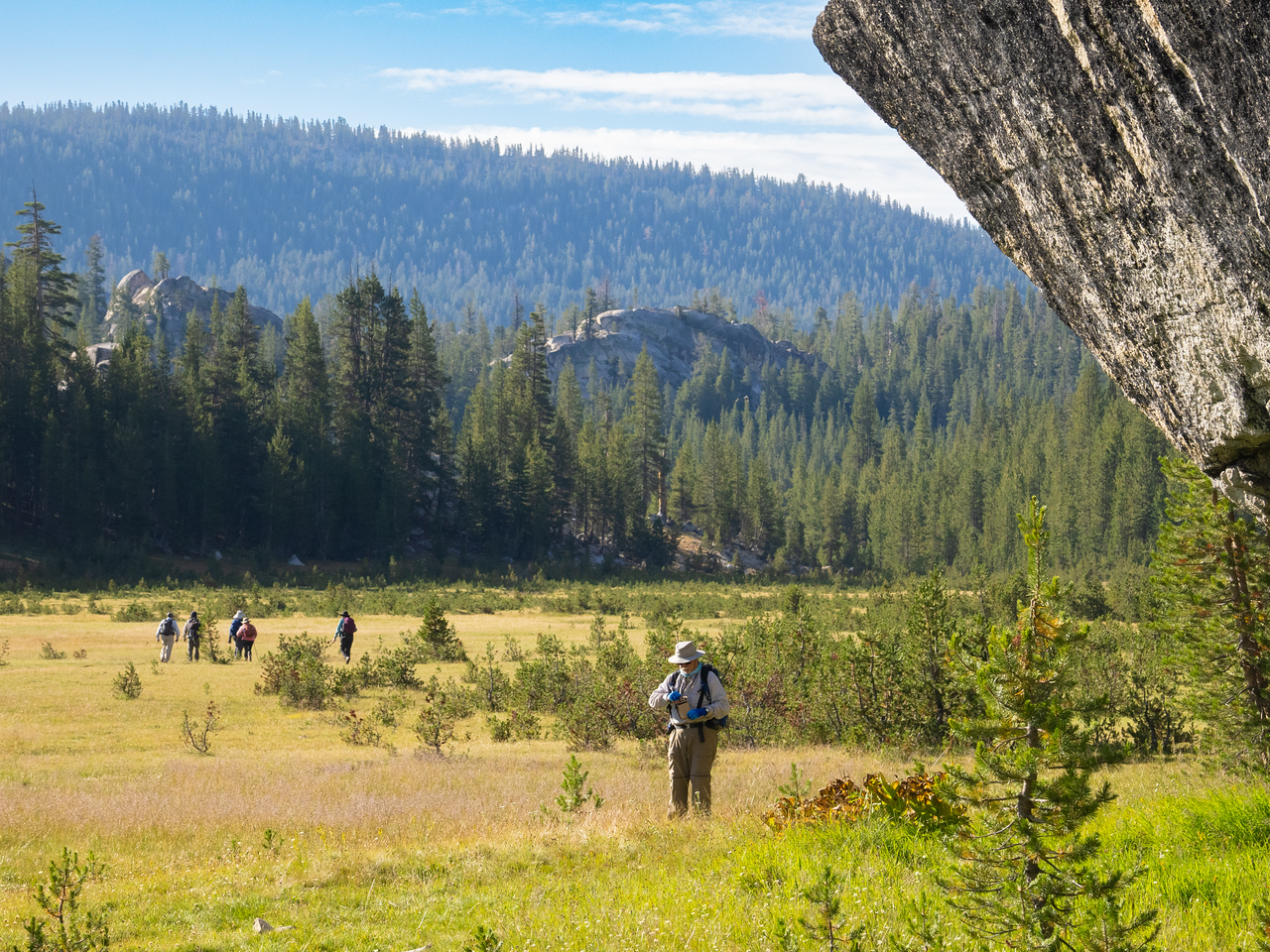
Day 1: TRAVEL DAY
You will be treated to a delicious breakfast as you meet your fellow hikers and
are introduced to camp-to-camp hiking in the Sierra backcountry. The hike
from Virginia Lakes starts through subalpine forest, eventually leaving tree line
with expansive views of the ancient metamorphic rock of the surrounding
peaks. The route tops out at Summit Pass where you will descend into one of
Yosemites deep, glacier-carved canyons. Stark granite peaks rise above tree-
covered lower slopes with Return Creek meandering through the meadows of
the valley floor.
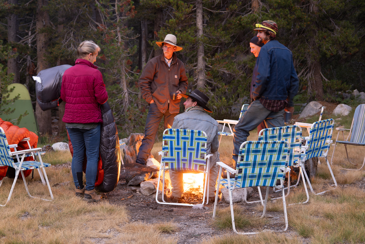
Your crew, along with the loaded mules, will have passed you during the day
and will have your gear waiting for you along with some appetizers on the
kitchen table. The cook will be preparing your dinner while the packers care
for the stock and equipment, set up the sit-down toilet, put out the lawn chairs,
and gather firewood.
You will stay two nights at our camp in the trees by the meadow-lined creek to
allow you to explore the canyon and perhaps take a hike to enjoy the view
from Virginia Pass.
6.8 miles, 1,550 gain, 2,140 loss
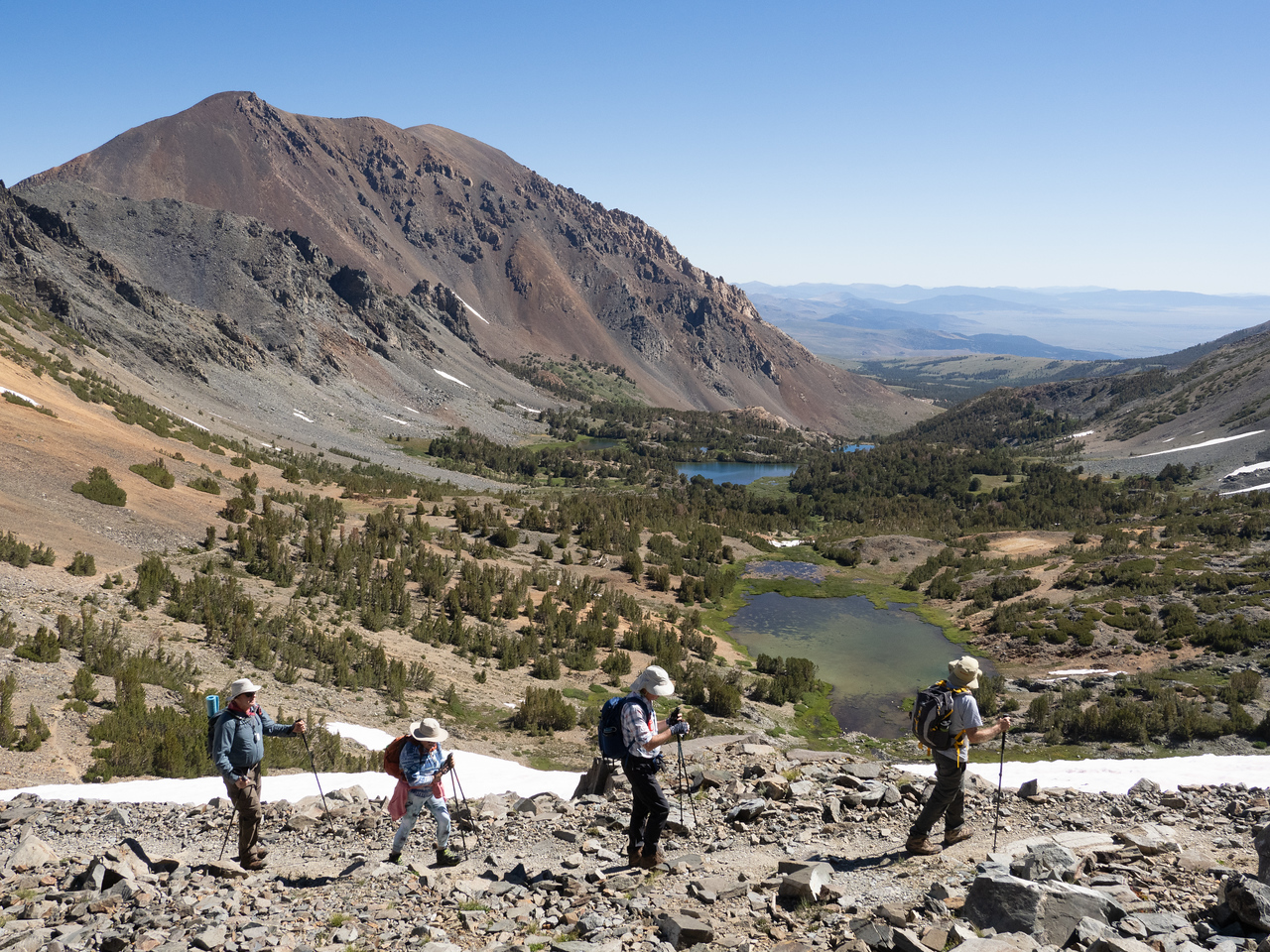
Day 2: TRAVEL DAY
You will wake up to the smell of piping hot cowboy coffee as the cook
prepares breakfast and sets out food for you to make your own lunch. The
hike begins with an easy stroll down Virginia Canyon to the junction with the
Pacific Crest Trail. The path follows Return Creeks beautiful cascading water
that has formed a line of potholes in the smooth bedrock granite. The trail
ascends the shaded south wall of Virginia Canyon into the Cold Creek
drainage. Our camp is at the edge of the long meadow of upper Cold Creek.
You will stay two nights at the camp. Mattie Lake beckons fishermen with the
promise of hungry brook trout.
8.4 miles, 740 gain, 1,210 loss
Day 3: LAYOVER DAY
Day 4: TRAVEL DAY
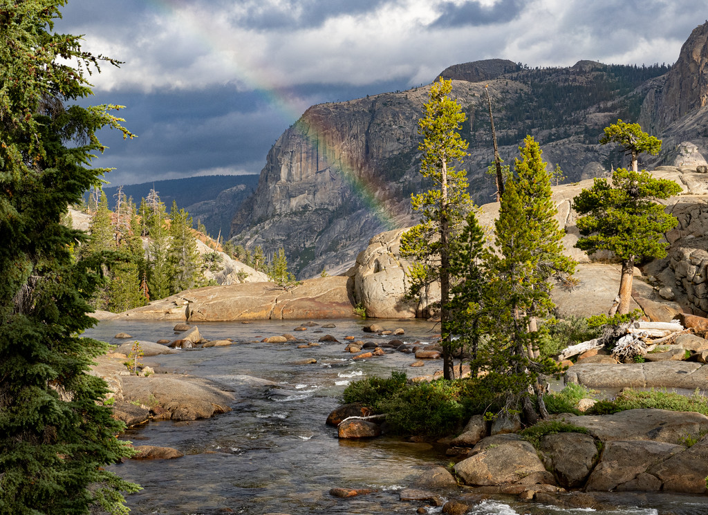
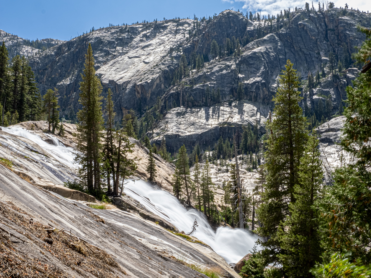
Continuing south on the Pacific Crest Trail, you will soon enter the forest with
great view opportunities as you descend to our next camp on the Tuolumne.
This section of the river is a mix of wild cascades and waterfalls and deep,
slow-moving water. Our camp is near a calm section of river that is perfect for
bathing, but the lure is to hike down-canyon to see California, Le Conte, and
Waterwheel Falls. The short distance between camps is designed to let you
follow that urge.
4.3 miles, 230 gain, 1,100 loss
Day 5: TRAVEL DAY
Some say we saved the best for last, but you can be the judge. We follow the
Tuolumne River past Tuolumne Falls and a long series of cascades. Moving
in and out of the forest, you will be treated to captivating views and even a
small version of Devils Postpile across the river.
The trip ends at the Tuolumne Meadows stables where you and your gear will
be shuttled back to the pack station.
5.4 miles, 1,080 gain, 330 loss
LAYOVER DAY TRIPS AVAILABLE
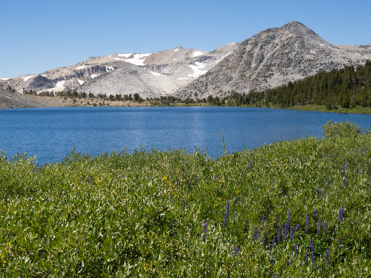
Miller Lake
8.6 miles round trip / 4.3 miles, 1,300 gain, 500 loss to Miller Lake
The day starts with a gentle descent down Virginia Canyon to the junction of the Pacific Crest Trail at mile 0.8. The trail to the right continues down the canyon before climbing 1,000 fairly steeply up Spiller Creek to a saddle at mile 4.6. Wonderful views to the west open up as the trail undulates another 1.4 miles to Miller Lake. The lake is shallow which makes it a good swimming lake. There are wonderful views across the canyon of the Tuolumne River as far as the Cathedral Range to the south from near the outlet of the lake or the low dome to the west of the lake. Return to camp by the same route.
McCabe Lakes
6.8 miles round trip / 3.4 miles, 1,300 gain, 150 loss to Lower McCabe Lake
Follow the trail down to the junction with the Pacific Crest Trail (PCT) at mile 0.8. Turn left, crossing Return Creek and McCabe Creek and then climb 570 through forest in one mile to the McCabe Lakes junction. Follow the trail to the left, climbing an additional 730 in 1.5 miles to the lake.
Waterwheel Falls
4.4 miles round trip / 2.2 miles, 100 gain, 1,100 loss to Waterwheel Falls
The day starts on a flat trail, cutting off bends in the river to arrive at the top of California Falls at mile 0.6. The trail drops beside the falls for 200 in 0.2 miles and then follows a placid section of the river for 0.4 miles. The path moves in and out of forest as it drops 550 over 0.6 miles to Le Conte Falls. The trail drops an additional 150 over 0.4 miles as the river swings away and then returns to the trail at Waterwheel Falls. Watch for a side trail to the left that leads to a great view of the falls. Take care to avoid the very slippery wet slick rock.
Please note that this represents the planned itinerary. Weather or other factors may affect the choice of campsites and daily travel. All decisions are made by the Head Packer with attention to the safety and comfort of guests and stock.
What you need to know
for hikers on pack stock supported trips
Dunnage limit is 30 lbs. per person (this includes sleeping bags, fishing equipment, liquor, etc.)
You may bring your own tent up to 10 pounds that is in addition. The PCT 28 day trip allows 35 pounds of duffel.
PERSONAL CHECK LIST
Bring belongings in stout canvas or nylon duffels; side zipper recommended, ideal size approximately 14" x 32". It is a good idea to use a large plastic bag INSIDE of the duffle to protect contents from external moisture.
Sleeping bags can be in separate duffels --again, line the inside of the duffle against rain.
Place all cosmetics, soaps, medications, etc into small plastic containers with close-fitting caps, THEN into sturdy resealable plastic storage bags. If anything breaks or bursts from altitude changes, the plastic bag contains the spill.
When possible, it is a good idea to transfer alcoholic beverages to sturdy plastic bottles with well fitting caps - it will save weight and protect against breakage.
ESSENTIALS
- Footwear. For this trips a medium-weight pair of hiking boots. We
do not recommend lightweight hikers or tennies since they give
little ankle support and the soles are often thin.
- Camp Shoes. A lightweight pair of tennies or Tevas to wear in
camp. This will reduce vegetation damage at our campsites.
- A day pack. It should be large enough to take water, extra clothing, rainwear,
camera, etc during the days.
- Sleeping Bag. Most summer trips are warm and a bag rated to
about 25°F will be plenty warm enough. We much prefer down
bags, and good quality ones at that. Your bag should weigh in
around 3 pounds.
- Sleeping pad. A 3/4 or full length closed cell foam or Thermarest.
If you bring a Thermarest also bring a repair kit to fix pesky holes!
- Coffee mug (plastic for camp)
CLOTHING
- 2 pair synthetic liner socks.
- 2 pair heavier synthetic or wool blend socks.
- Long underwear top. Capilene, some other synthetic or the new
pure Merino wool types.
- Long underwear bottom.
- Warm pants. Tights or Expedition Weight Capilene.
- Warm shirt. Synchilla or R2 weight works well.
- Another fuzzy sweater top or pile jacket of some sort
- GoreTex Jacket and Pants. A lightweight set is sufficient and heavy
bulky clothing is unnecessary. Side zips on the pants should be
long enough to slide over boots. Jacket must have a hood. Do not
skimp on your rain gear. Nylon ponchos are not acceptable.
- Shorts for on the trail
- Tee shirt for on the trail
- Lightweight capilene or similar gloves.
- Warm hat. Synthetic or wool.
- Sunhat
ETC.
- Sun glasses.
- Water Bottles. Two quart (1 liter) wide mouth bottles and/or a hydration
system holding up to 50oz. (2 liters). Dont bring bike bottles or
any bottle that doesnt have a wide opening.
- Headlamp. --and a spare set of batteries!
- Pocket knife. Swiss army style.
- Personal toiletries. It is not necessary to smell like a rose each day
so do not over do it.
- Ear plugs are great to have in a noisy tent.
- Personal Medical Kit. The guide will carry a large kit so yours will
predominately consist of foot repair items, mild pain killer such as
Advil and bandaids.
- Sunscreen and lip screen. SPF 30+. A 1oz. bottle will be enough.
Make sure the lip stuff actually contains a sunscreen.
- Bug repellent.
- Camera. A spare battery and card are good backups
- Ski/trekking poles. These are not essential, but can be handy on
the trail. It is your choice, but they do save wear on the knees.
- Plastic trash bag. Handy for keeping gear in outside the tent
should it rain.
- Optional reading material, etc.
FOOD
We provide the all meals on scheduled trips. You can bring
your favorite "on-the-trail" snacks.
OPTIONAL ITEMS
- Small notepad and pencil
- Collapsible plastic wash basin (optional)
- Solar shower (optional)
- Water filtering pump (optional)
- Liquor (be sure to check in with the packers to see that your liquor is packed safely)
- Fishing equipment (optional)
- Rod/reel/line (a rod that breaks down into 3 or more pieces is recommended)
- Compact metal rod case to carry on saddle
- Canvas creel (no tackle boxes)
- Leader material (1-3 lb.)
- Flies: black gnat, mosquito, grey hackle, brown hackle, & royal coachman (No. 12-14 hooks)
- Bait: worms & Pautzke red eggs
- Egg hooks, worm hooks (No. 10-14)
- Split shot
- Lures (personal choice)
- Pliers
You can purchase quality topo maps at TOM HARRISON MAPS.
Tom Harrison Hoover Wilderness Map, paper or download onto phone/tablet. A short section of the trail missing from the map includes Miller Lake, which is on the Yosemite High Country map.
National Geographic 308 Yosemite NE: Tuolumne Meadows and Hoover Wilderness Trail Map
Apps for Smartphone/Tablet, download applicable areas prior to departure: