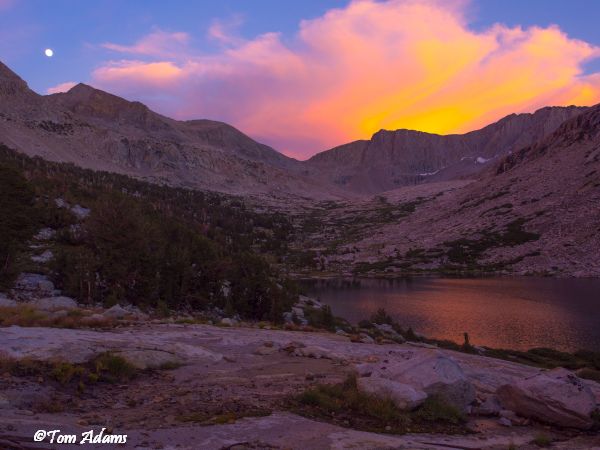
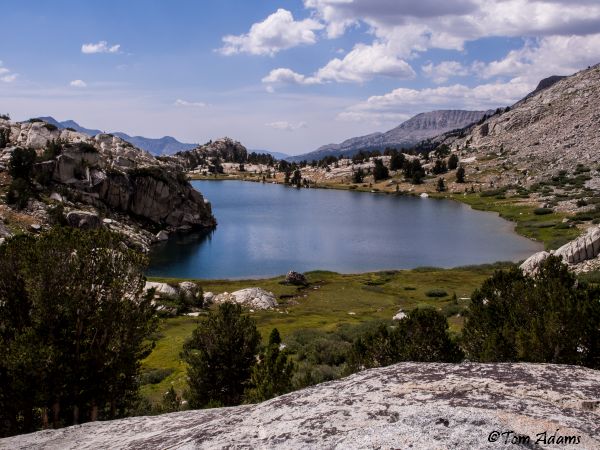
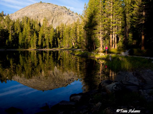
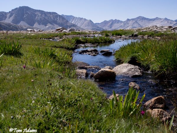
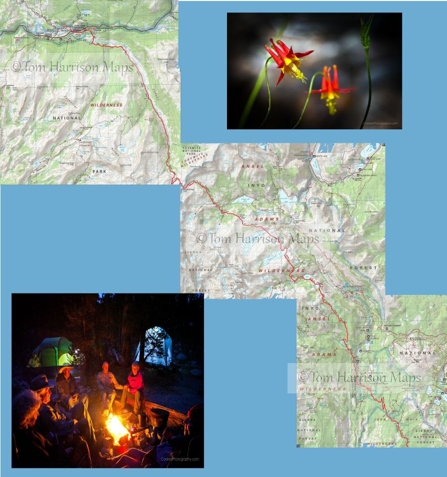
John Muir Trail/Pacific Crest Trail Ride
Horseshoe Meadows to Happy Isles
Daily Itinerary for the John Muir/Pacific Crest Trail Ride
Please note that this represents the planned itinerary. Weather or other factors may affect the choice of campsites and daily travel. All decisions are made by the Head Packer with attention to the safety and comfort of guests and stock.
Segment 1: Horseshoe Meadow to Charlotte Lake
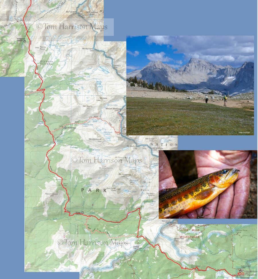
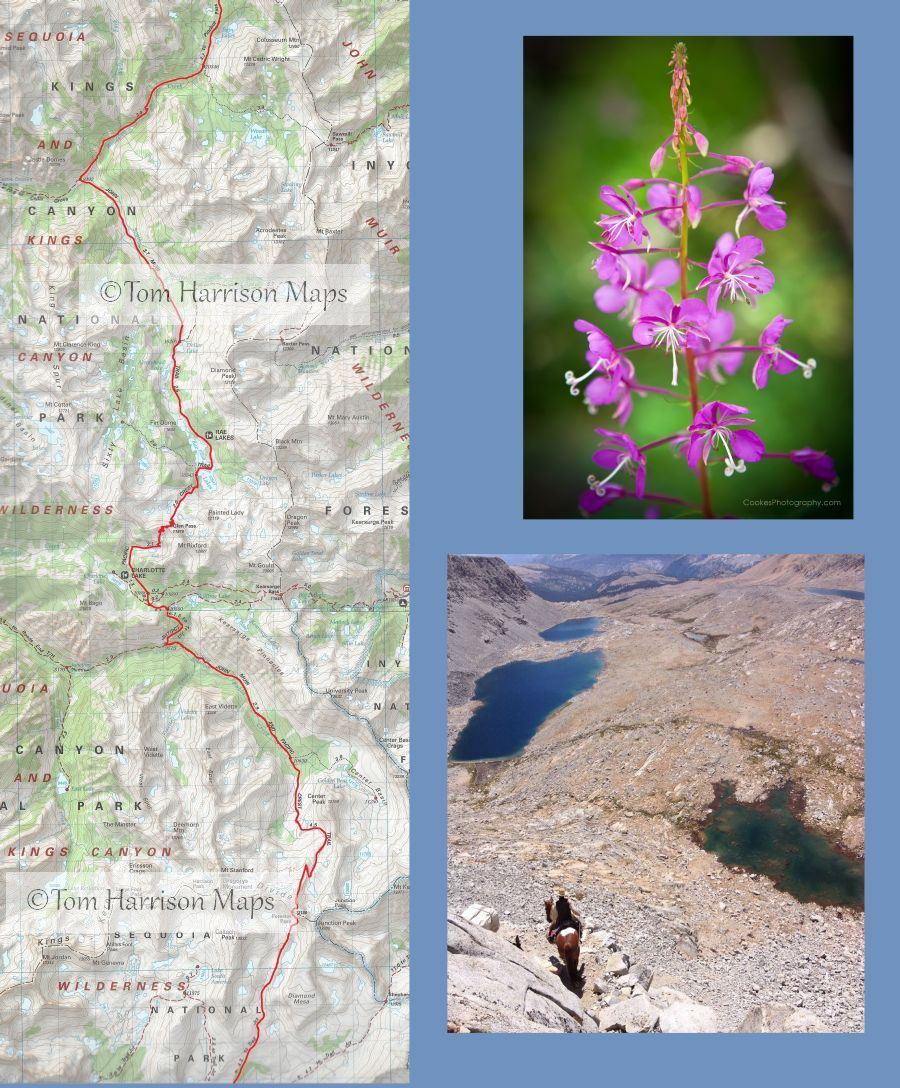
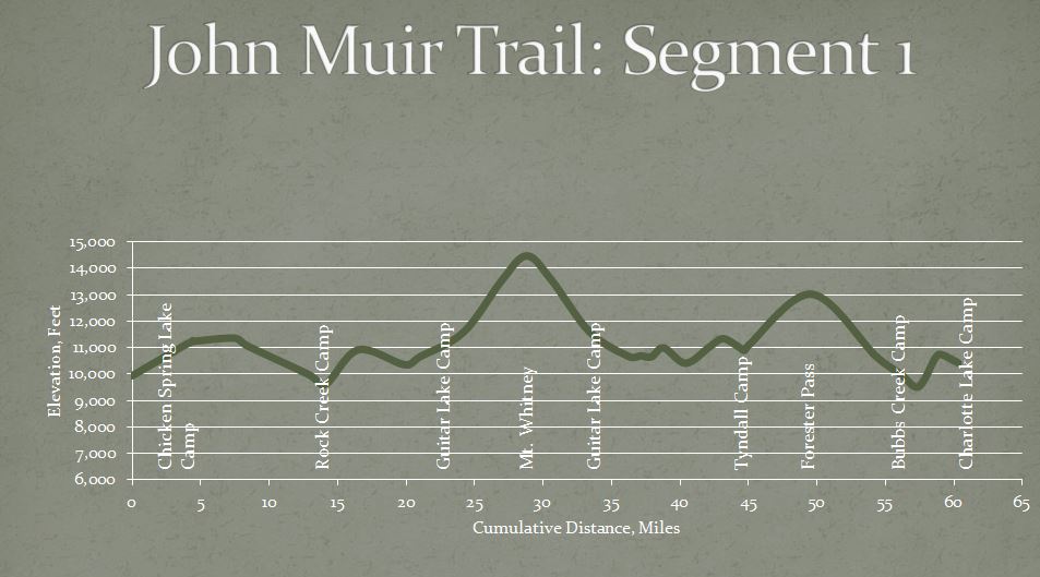
Overview: The first segment of the trip includes the opportunity to summit Mount Whitney. The trip starts with a hearty meal at the home of owner, Craig London, before travelling to the trailhead at Horseshoe Meadows. We will cover 23 miles following the Pacific Crest Trail over three days to stage for the ascent to Mount Whitney at Guitar Lake. The top of Mount Whitney begins the start of our trek along the John Muir Trail. We will then follow the JMT north enjoying views of the Kaweah Range to the west and the Sierra crest to the east before crossing over Forester Pass, the highest pass on the John Muir Trail. Dropping into a U-shaped valley we will follow Bubbs Creek to Vidette Meadow before climbing over a low ridge and finally descending to beautiful Charlotte Lake 61 miles and seven days from the trailhead.
Day 1 Horseshoe Meadow over Cottonwood Pass to Chicken Spring Lake
4.5 miles, 1,400 gain, 100 loss
The day will start with a 6:00 breakfast at 245 Rocking K Road, Bishop, and then the two-hour ride to the Horseshoe Meadows trailhead. The walk begins as a gentle ascent beside the meadow for a mile before entering the open forest to climb steadily to 11,160 Cottonwood Pass by mile 3.8. We will turn north onto the Pacific Crest Trail, walking another half mile before leaving the trail to follow the creek a short distance up to Chicken Spring Lake.
Day 2 Chicken Spring Lake to Rock Creek
9.9 miles, 600 gain, 2,300 loss
Returning to the Pacific Crest Trail, the path climbs briefly, gaining 300 in the first mile and then undulates along the side of the mountain with good views of Big Whitney Meadow to the left. The trail enters Sequoia National Park in three miles, dropping steadily through open forest the rest of the day, passing the Siberian Pass junction at mile four and the Upper Rock Creek Trail junction at mile 8.5. The trail will finally cross Rock Creek and then we will follow a use path down the north side of the creek to our camp alongside a beautiful meadow edged by the creek. The creek crossing might be tricky if there has been recent rain.
Most of the seasonal streams in this area will be dry with no reliable water until we approach Rock Creek at the end of the day. Be sure to leave Chicken Spring Lake with plenty of water.
Day 3 Rock Creek to Guitar Lake
9.8 miles, 3,050 gain, 1,050 loss
The day starts with a steady climb out of the Rock Creek drainage to Guyot Pass, 1,400 in 2.5 miles. Views to the south are of Forgotten Canyon. Dropping down from the pass, the trail traverses the hillside on a sandy trail. Twisted foxtail pines frame views of Red Spur across the Kern Canyon. A brief climb into the Whitney Creek drainage, before we drop 400 to the Whitney junction near the creek, which is about six miles from our camp. Turn onto the trail to Whitney, following Whitney Creek and passing the ranger station before joining the John Muir Trail in 1.1 miles. Turn up canyon toward Mount Whitney, passing out of the trees at Timberline Lake and finally stopping at our camp above Guitar Lake. Mount Whitney towers 3,000 above us to the east.
There is fairly reliable water about a mile out of camp, with the next reliable water at Whitney Creek, 6 miles from the Rock Creek camp.
Day 4 Mount Whitney
9.2 miles, 3,100 gain, 3,100 loss
Mount Whitney provides several hours of shade after sunrise making the long climb to the top in the treeless landscape less daunting, so plan to leave camp at dawn. The trail starts off to the southeast for about a mile before starting to climb the steep wall on long switchbacks. Look across Hitchcock Lakes to Mount Hitchcock to gage your progress up the mountain, as Trail Junction, at 13,484 feet, is only 300 above Mount Hitchcock. Go left at the junction to follow the fairly narrow trail cut into the rock on the west side of the pinnacles. There are several windows providing stunning views to the east. Another 1.9 miles and 1,000 elevation gain takes you to the top. Enjoy your time at 14,496.811 feet before leaving the crowd at the top and returning to your wilderness camp at Guitar Lake.
p class="padding">
There is no reliable water between Guitar Lake and the top of Mount Whitney.
Day 5 Guitar Lake to Tyndall Creek Frog Ponds
10.6 miles, 1,750 gain, 2,250 loss
We retrace our path 2.6 miles down the trail past Timberline Lake to the junction at Lower Crabtree Meadow, but this time we follow the John Muir Trail to the right for 0.8 miles to merge with the Pacific Crest Trail. The trail soon skirts the east side of Sandy Meadow with views to the west of Red Spur. The trail climbs a low ridge before dropping down to Wallace Creek which can usually be crossed on rocks. The creek runs through an open meadow surrounded by pines and the crossing is a pleasant lunch spot at 6.8 miles. Continue north past the Kern River junction to climb up a ridge to meadows of Wright Creek with stunning views to the east of the Sierra crest including Mount Whitney. The 1,000 ascent out of Wallace Creek tops out at the treeless Bighorn Plateau with views of the Kaweah Range and the Kern River Basin to the west before dropping down to our camp at the frog ponds near Tyndall Creek.
There is reliable water at Wallace Creek and Wright Creek.
Day 6 Tyndall Creek Frog Ponds over Forester Pass to Bubbs Creek
11.9 miles, 2,250 gain, 3,300 loss
We drop ½ mile down through open forest to the Tyndall Creek crossing and then start the 2,300 climb over 4.4 miles to the top of 13,180 Forester Pass, the highest pass on the John Muir and Pacific Crest Trails. The trail begins through alternating forest and meadows. The landscape becomes more austere as the trail approaches and is cut from the headwall of the Kings Kern Divide. The last mile switchbacks up the right side of the pass before crossing over to the left side with tight switchbacks over the final grade. One is rewarded at the top with spectacular views of the Great Western Divide, the Kaweah Range, and the tall peaks north of Mount Whitney. Turning north, the trail enters Kings Canyon National Park, dropping down steep switchbacks. The rocky terrain gives way to forest with the final few miles a pleasant walk along Bubbs Creek to Vidette Meadow.
Day 7 Bubbs Creek to Charlotte Lake
4.2 miles, 1,300 gain, 850 loss
The trail continues to follow Bubbs Creek to the lower meadow before turning north to climb 1,200 in almost two miles to the Charlotte Lake Junction. Turn off the John Muir Trail to drop 1.3 miles to a comfortable camp near the outlet of Charlotte Lake.
Day 8 Layover at Charlotte Lake
A day to recover from some long, high-altitude hikes with large elevation gains.
Segment 2: Charlotte Lake to Big Pete Meadow
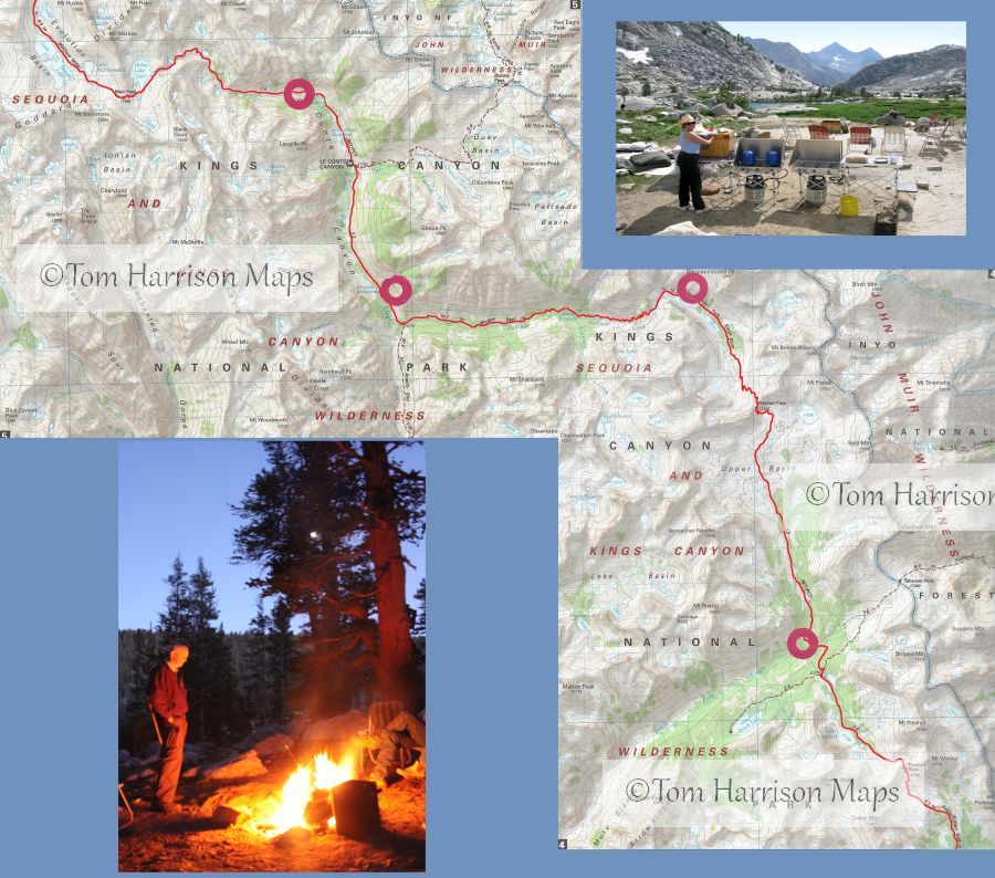
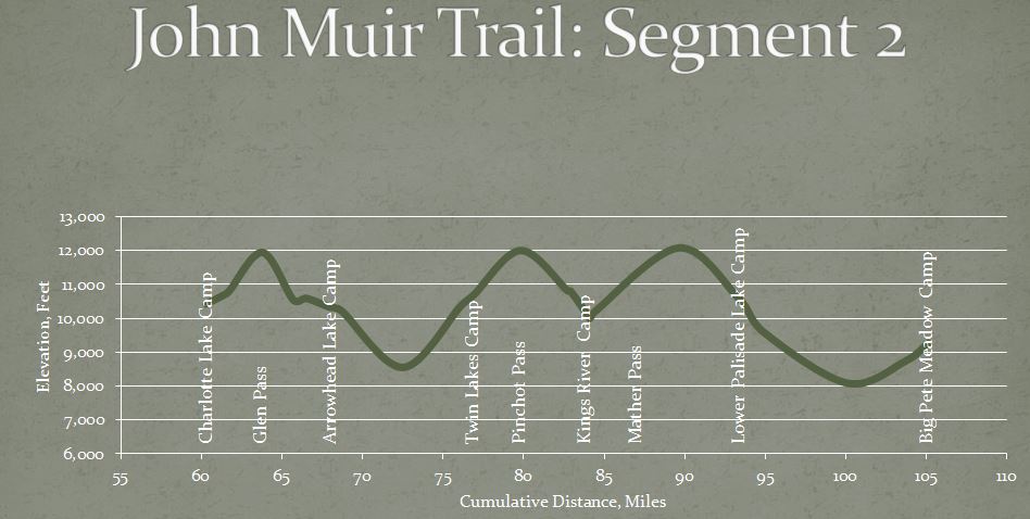
Overview:This is truly the Sierra High Country. We will climb over three 12,000 passes and walk down the famous golden staircase. Hiking above tree line for much of this section affords us expansive views of the glacial cut granite walls of Kings Canyon National Park. The varied landscape rewards us with cascading creeks as well as serene meadows along much of the hike.
Day 9 Charlotte Lake over Glen Pass to Baxter Meadow Charlotte Lake over Glen Pass to Arrowhead Lake
7.7 miles, 1,750 gain, 1,850 loss
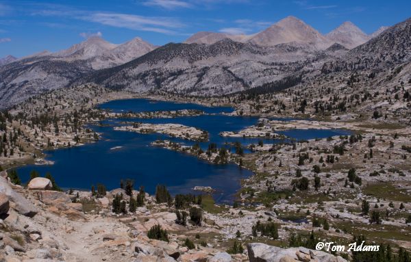
We will backtrack 1.3 miles to the John Muir Trail junction before turning north toward the narrow ridge of 11,978 Glen Pass. The day will start in forest, but soon climbs out of the shade to rocky slopes as it approaches the pass. You will pause at the top to celebrate the climb, but you will stay to enjoy the spectacular view. Eventually drop down from the pass for lunch at the beautiful Rae Lakes and on to our camp by Arrowhead Lake.
Upper Rae Lake at mile 5.5 is the first reliable water source.
Day 10 Baxter Meadow to Twin Lakes Arrowhead Lake to Twin Lakes
9.1 miles, 2,100 gain, 1,850 loss
We will spend the first half of the day walking 4.6 miles down a pleasant trail through forest and occasional meadows to Woods Creek. We can keep an eye out for one of Shortys cabins off to the right just before we reach the creek. Crossing a suspension bridge at 8,492, we turn right and start back up through mostly forested slopes to 10,600 in almost four miles. This is a quiet day after the excitement of Mount Whitney, Forester Pass, and Glen Pass, but the views and sounds of cascading creeks surrounded by rocky canyon walls make this a great day of hiking.
There are several creek crossings along Woods Creek with reliable water.
Day 11 Twin Lakes over Pinchot Pass to the South Fork of the Kings River
7.5 miles, 1,550 gain, 2,150 loss
The hike starts near tree line, so most of this day will be hiking in open alpine meadows and rocky slopes surrounded by multicolored rock walls along the way to 12,130 Pinchot Pass. The easy descent down the north side has a series of lakes before entering the forested area above the South Fork Kings River. The Lake Marjorie shoreline, at about mile 4.6, and the stream crossing in another Ό mile are two great lunch spots. A side trip just before the drop to the Kings River to beautiful Bench Lake is worth the 250 drop and gain over 3.4 miles.
As the trail approaches camp, it first crosses a fast creek coming from Taboose Pass and then comes to the Kings River Ό mile later. The camp is between the two streams and to the left, at the 10,000 level.
There are some seasonal creeks along the trail, but Lake Marjorie is the first reliable water after leaving camp.
Day 12 South Fork of the Kings River over Mather Pass to Lower Palisade Lake
9.3 miles, 2,200 gain, 1,550 loss
The trail soon leaves the forest to a series of lovely alpine meadows and finally into a barren rocky landscape with some scattered ponds at the base of the massive wall that hides Mather Pass. A series of switchbacks take us up the last of the climb to the 12,100 pass at mile 5.5 to enjoy expansive views of the trail behind and the basin ahead. The trail drops steeply with large steps and lose rubble forcing us to tear our eyes away from the classic glacial walls of the Palisade drainage. The trail turns to dirt below the switchback around mile seven as it aims steadily toward the Palisade Lakes below you. Be sure to stop at the creek running into the east side of the upper lake to enjoy a small waterfall, wildflowers, and a great foot soak. Camp is at the far end of the lower lake.
There are several creek crossings approaching and leaving Mather Pass for water.
Day 13 Camp Lower Palisades down the Golden Staircase to Big Pete Meadow
11.9 miles, 1,400 gain, 2,800 loss
The day starts down the much- talked- about Golden Staircase, a steep set of well-designed, tight switchbacks dropping over 1,500 in about two miles. Southbound JMT hikers usually climb this and then Mather Pass on the same day, often in blazing sun. We go down in the morning shade. The trail remains in the forest much of the day as it follows first Palisade Creek and then turns up the Middle Fork of the Kings River. Grouse Meadow is the perfect place for a quick dip and a wonderful view of spectacular Le Conte Canyon. This is a long day, but the path from the bottom of the staircase drops only 1,100 in 4.5 miles, before climbing 1300 in five miles.
Day 14 Layover Day
This is a comfortable camp along the Middle Fork of the Kings River. The river's many pools are deep enough for a good dunking and there are plenty of bushes to dry your laundry. Its worth exploring around camp to observe the meadow's peat layer and carnivorous plant.
Segment 3: Big Pete Meadow to Quail Meadow
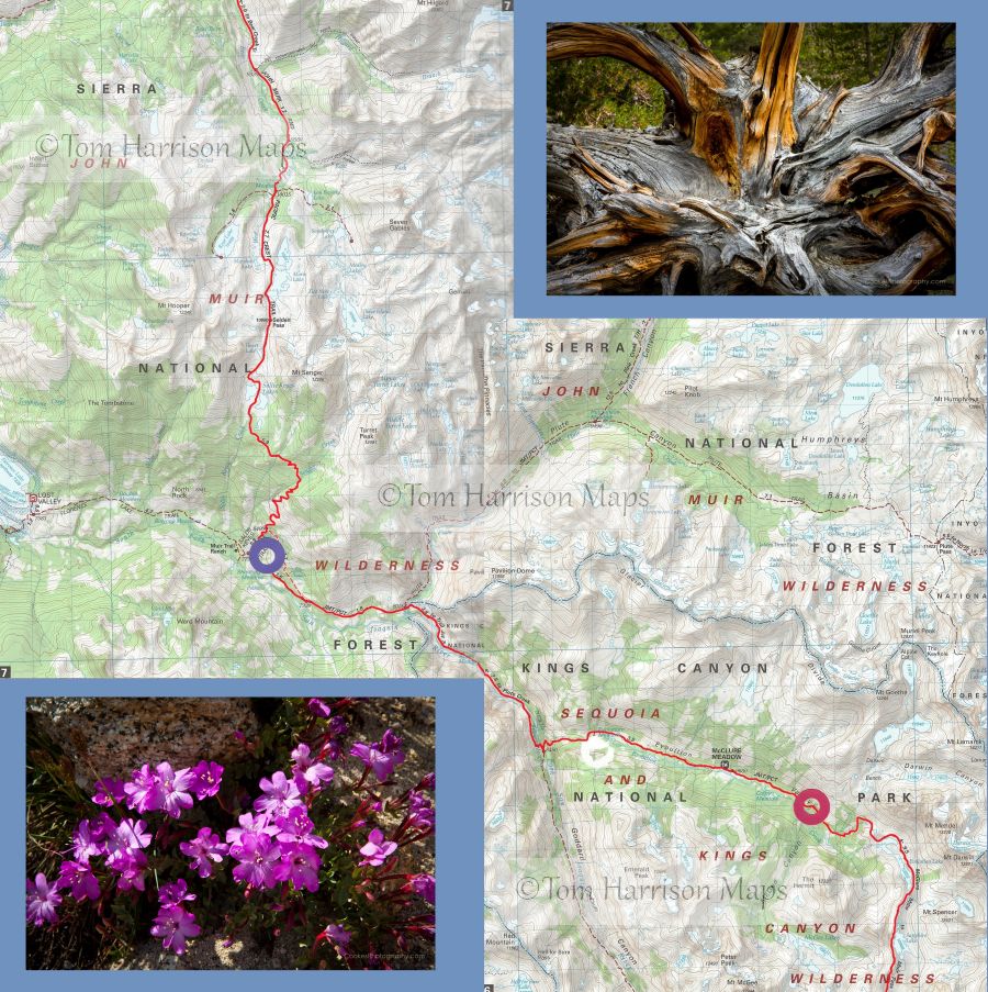
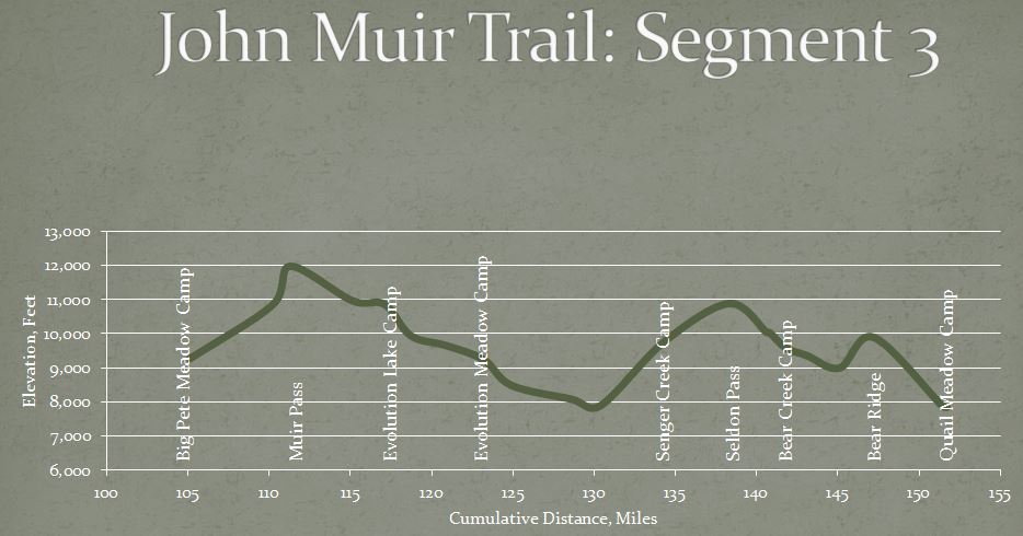
Overview: The California Sierra has so much to offer. Granite cliffs, flower strewn meadows, thundering waterfalls, pristine lakes and deep calm rivers. Some days in the Sierra are magical. This section of the John Muir Trail journeys through Kings Canyon National Park and the John Muir Wilderness of Sierra National Forest treating you to more wonder per mile than any other section of the trail.
Day 15 Big Pete Meadow over Muir Pass to Evolution Lake
12 miles, 3,000 gain, 1,400 loss
The trail follows the Kings River past meadows and cascades before leaving the trees after ascending 1,600 in 3.4 miles. The barren, daunting landscape ahead can only be described as majestic, with the Black Divide to the west and the Goddard Divide to the north. We climb another 1,200 in 2.7 miles to Muir Pass, passing several lakes, including large Helen Lake. The top of 11,976 Muir Pass has the only structure on the John Muir Trail between Tuolumne Meadow and Mount Whitney, a small stone hut. The views from the pass are simply tremendous. The trail drops down into Evolution Basin with glacial cut walls and shelves with tarns and lakes. We will camp near the outlet of Evolution Lake, enjoying the view up-canyon as the afternoon light turns the rocky peaks golden.
Day 16 Evolution Lake to Evolution Meadow
6.1 miles, 100 gain, 1,700 loss
This is as close as one can get to easy day hiking in the Sierras. We will leave our perch on the edge of Evolution Basin, to drop 900 in 1.4 miles on a loamy trail to a series of meadows, first Colby, then McClure, and finally, our destination, Evolution Meadow. The meadows and trees seem greener in comparison to the rocky, barren landscape of Muir Pass.
Day 17 Evolution Meadow to Senger Creek
11 miles, 2,150 gain, 1,650 loss
This is a day to enjoy the sight and sound of rushing water as the trail follows Evolution Creek and then the San Joaquin River. The day starts with a wade across Evolution Creek and then following its south bank before veering away to switchback down through forest to a bridge crossing of the South Fork of the San Joaquin River at mile 1.9, crossing on another bridge at mile 2.8. The trail continues to follow the energetic San Joaquin River to a bridged crossing of Piute Creek as the John Muir Trail leaves Kings Canyon Nation Park and enters the John Muir Wilderness of the Sierra National Forest. Our second day of downhill hiking ends at mile 7.2 as the trail begins the climb to Seldon Pass, first through forest and then through mixed forest and manzanita before reentering the forest. We will ascend 1,900 feet in 3.8 miles to the meadow above the Senger Creek crossing.
Water is abundant.
Day 18 Senger Creek over Seldon Pass to Bear Creek
7.6 miles, 1,350 gain, 1,450 loss
Our climb to Senger Creek the previous day gave us a head start on the pass. The trail climbs 600 in two miles to the beautiful Sallie Keyes Lakes, around pretty Heart Lake, and finally topping out at 10,910 Seldon Pass in four miles. The view Marie Lake from the pass is breathtaking. This is an easy pass compared to those behind us with an easy walk of only ½ mile and less than 400 to the shores of Marie Lake. Our path today takes us past Rosemarie Meadow to our camp at Upper Bear Creek Meadow.
Day 19 Layover at Bear Creek
There are excellent day hikes out of the Bear Creek camp including:
- Ruby Lake
- Seven Gables Lake
- Sandpiper, Medly, and Three Island Lakes via Lou Beverly Lake
- Orchid Lake
Day 20 Bear Creek to Quail Meadow
9.8 miles, 1,100 gain, 2,900 loss
The trail follows Bear Creek for three miles through forest. After dropping about 600, the trail leaves Bear Creek and starts to climb toward Bear Ridge, climbing 1,000 in 2.5 miles, mostly forested with some lovely views. The trail then drops over 2,100 down the forested north side of Bear Ridge, finally crossing over Mono Creek on a bridge to meet the trail to Edison Lake in four miles. Follow the sign to Edison Lake, walking Ό mile to our campsite at Quail Meadow.
There is reliable water along Bear Creek and then at Mono Creek.
Segment 4: Quail Meadow to Tuolumne Meadow
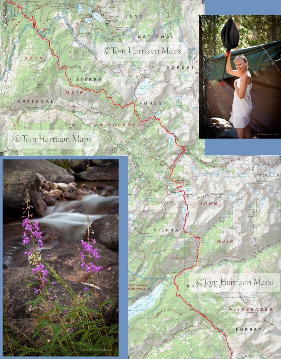
Overview: You have now summited Mount Whitney, walked over eight passes, descended the Golden Staircase, and experienced over 150 miles of Sierra wilderness few people will ever see. Now it is time to experience the grandeur of the Ansel Adams Wilderness with the Minaret Spires and the Ritter Range escarpment towering over green meadows and alpine lakes. Enjoy the unique columnar basalt and the beautiful Rainbow Falls of Devils Postpile National Monument. Climb over Donahue Pass to follow the Lyell Fork of the Tuolumne River before ascending one more time past Cathedral Lakes before the long descent to Yosemite Valley. A four-mile side trip on the last day takes you off the John Muir Trail to the top of Half Dome for breathtaking views of Yosemite from this remarkable granite dome.
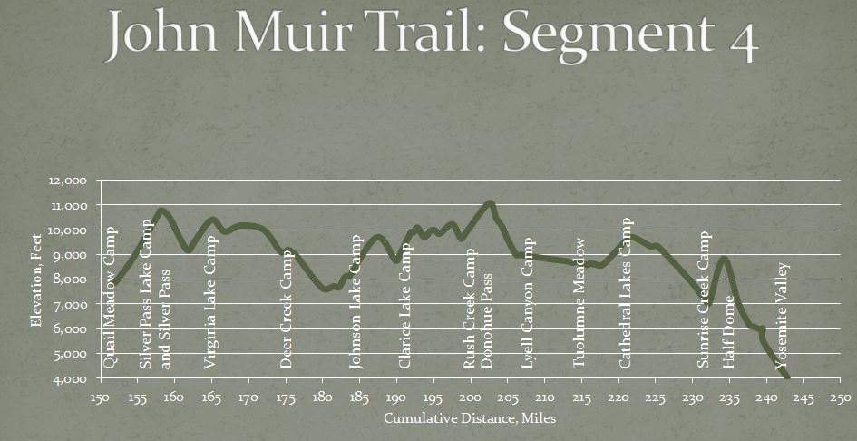
Day 21 Quail Meadow to Silver Pass Lake
5.7 miles, 2,600 gain, 50 loss
This is a day of rushing water and granite slabs. Walk the Ό mile back to the John Muir Trail and turn north toward Silver Pass. The trail soon crosses the North Fork of Mono Creek and climbs 400 to the Mono Pass Trail junction. The trail follows the east bank of the creek for 1.4 miles to Pocket Meadow and the junction to Mott Lake. Crossing the creek, the trail steepens on forested switchbacks, passing Silver Pass Meadow before climbing to Silver Pass Lake at mile 5.7.
Day 22 Silver Pass Lake over Silver Pass to Virginia Lake
7.6 miles, 1,850 gain, 1,900 loss
It is only a short walk of 0.7 miles to 10,779 Silver Pass. Plan to spend some time at Silver Pass as the views are absolutely stunning. You can see the Minarets, Ritter, and Banner in the distance; peaks you will pass in a few days. The trail descends through alpine lakes surrounded by granite cirques and meadows peppered across the stone slabs, eventually dropping through thick forest to the Cascade Valley Junction at mile 4.2. The trail follows cascading Fish Creek to Tully Hole before climbing up exposed switchbacks to beautiful Lake Virginia. The wonderful views south provide an excellent excuse to catch your breath.
Be prepared for numerous stream crossings.
Day 23 Virginia Lake to Deer Creek
9.3 miles, 1,150 gain, 2,400 loss
The trail climbs briefly over a low ridge before dropping to Purple Lake at mile 1.7. After a brief climb, the trail contours along south facing hillsides, crossing the outlet from Duck Lake, before finally descending on a dusty trail to Deer Creek at mile 9.3.
Be sure to fill up your water bottles at Duck Creek, as there is no reliable water between Duck Creek and Deer Creek.
Day 24 Deer Creek to Johnston Lake
9.2 miles, 950 gain, 1,900 loss
The trail leaves Deer Creek, contouring along the hillside before descending slowly to the Mammoth Pass junction at mile 2.2. Continuing north, the trail drops another 1,300 in 3.4 miles through forest, portions recovering from a 1992 lightning strike, as it approaches Reds Meadow. Follow the John Muir Trail to the fascinating basalt columns of the Devils Postpile, with a possible side trip to Rainbow Falls. Be careful at trail junctions in the Devils Postpile area as this is where the John Muir Trail and the Pacific Crest Trail separate for a day. Be sure to follow the signs to the John Muir Trail and our camp on Johnston Lake.
Backpackers rejoice at this section of the trail as it affords them the opportunity to pick up fresh food at the general store and eat a hot meal at the cafι. You havent been eating freeze-dried food and your daypack already contains a lunch including a sandwich, cookies, fresh fruit, nuts, and a candy bar. You can bypass civilization and continue to enjoy the Sierra wilderness at you walk toward the beautiful Minarets.
Be sure to leave Deer Creek with a full water bottle.
Day 25 Johnston Lake to Clarice Lake
8.4 miles, 2,900 gain, 1,150 loss
The next three days take you through the heart of the Minarets area, with wonderful views of the Ritter Range and dozens of beautiful lakes. The trail climbs 1,000 in two miles to a saddle above Trinity Lakes and then continues to climb another 500 to arrive at Gladys Lake at mile 3.8. If you are ready for a break, walk around to the east side of Gladys Lake for a great view across the deep canyon of the San Joaquin River. The trail now drops 800 past Rosalie Lake to the junction at Shadow Lake. If you are full of energy, go left for a side trip to pretty Ediza Lake at mile 6.9, otherwise follow the John Muir Trail up toward the saddle above Garnet Lake. Camp will be at 9,903 Clarice Lake, a small lake about 0.2 miles to the right of the trail. If you reach the saddle above Garnet Lake, you have passed Clarice Lake by a half mile.
Numerous lakes and creeks provide ample drinking water.
Day 26 Clarice Lake to Rush Creek
7.6 miles, 1,650 gain, 1,450 loss
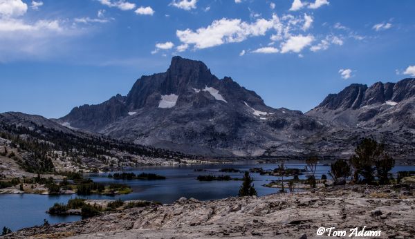
Plan to spend time enjoying the beauty of the many lakes you will pass today with the Ritter Range always looming to the west. Return to the 0.2 miles to the John Muir Trail and walk a half mile to the ridge overlooking Garnet Lake. Drop down 300 on easy switchbacks and then parallel the eastern bank, crossing the outlet at mile 1.6. Walk along the north shore for 1/3 mile before working your way over the 400 ridge to rejoin the Pacific Crest Trail at the outlet of Thousand Island Lake at mile 3.8. An easy 400 walk up to Island Pass before dropping down to follow Rush Creek up to camp.
Frequent water crossings provide ample drinking water.
Day 27 Rush Creek to Lyle Fork
6.9 miles, 1,100 gain, 2,250 loss
The trail follows a creek through high alpine meadows before climbing more steeply to 11,056 Donohue Pass at mile 2.7, the last pass before Tuolumne Meadow. Take one last look at the Ansel Adams Wilderness before stepping into Yosemite National Park. The trail drops 2,200 over the next 3.6 miles through beautiful scenery of creeks, small lakes, and huge slabs of granite, crossing a number of streams, before reaching the meadows of Lyell Canyon. Follow the trail another half mile to a pleasant camp between the trail and the river.
Frequent water crossings provide ample drinking water.
Day 28 Layover
Day 29 Lyle Canyon to Cathedral Lakes
14.0 miles, 1,450 gain, 900 loss
We have spent weeks climbing thousands of feet out of canyons up to views of stark granite mountains. The first 11 miles are an easy walk along the Lyell Fork of the Tuolumne River, moving in and out of the forest with the meandering river to our right. There is a junction to Ireland Lake and Vogelsang High Sierra Camp at mile 2.3 and then another junction after the bridge crossing of Rafferty Creek at mile 6.3. The trail is approaching the campground, stores, visitor center, etc. of Tuolumne Meadow. The trail avoids much of the crowd by swinging out into the meadow. Dont let the shock of the crowds keep you from spending time enjoying the spectacular views from the meadow.
Follow the JMT/PCT to the right, signed for Tuolumne Lodge, to cross the Tuolumne River on two bridges. Go left at the Gaylor Lakes junction at mile 7.6, crossing the Dana Fork of the Tuolumne River on a bridge at mile 7.7 and then immediately turn left to follow the trail along the river. Cross Highway 120, your first road in 215 miles of Sierra trails, and follow the dirt road passing through the gate at mile 9.1. The John Muir Trail and Pacific Crest Trail once again diverge, this time for good, at mile 9.4 where you will go left past Soda Springs and Parsons Lodge to follow the trail back across Tuolumne Meadow, crossing Highway 120 again at mile 9.8. The trail tees into the Tuolumne-Tenaya trail in 0.1 miles where you will turn right. The JMT turns left onto the Cathedral Lakes trail in one mile. You will climb 1,000 in three miles to camp to the left of the junction to the Lower Cathedral Lake.
Day 30 Cathedral Lakes to Sunrise Creek
10.8miles, 950 gain, 3,250 loss
The trail starts out in forest before opening up into the meadow surrounding the upper Cathedral Lake surrounded by Cathedral, Echo and Tresidder Peaks. A short climb to 9,700 Cathedral Pass before dropping down to Long Meadow to pass the Echo Creek junction at mile 3.6 and the Sunrise High Sierra Camp at mile 4.4. The trail climbs 400 over the shoulder of Sunrise Mountain before dropping steadily for 2,500 to camp just short of the Clouds Rest trail junction.
Day 31 Sunrise Creek to Half Dome to Happy Isles
11.2 miles, 2,050 gain, 5,200 loss
The Half Dome trail is 0.5 miles past the Clouds Rest trail junction. While Half Dome is not part of the John Muir Trail, this is a great opportunity to enjoy the magnificent views from the top. The last part of the two-mile ascent is over very steep, smooth granite with cables erected for safety, but is not for those with a fear of heights. Returning to the JMT, the trail drops to Little Yosemite Valley where we turn right at mile 6.1 to follow the Merced River down to Yosemite Valley.
The crowds will start as you approach Nevada Fall at mile 7.5. Suppress the urge to take the shorter Mist Trail and stay on the John Muir Trail. Cross over the river on the wooden bridge to enjoy a break at the top of the fall before starting down the trail on a series of long switchbacks on the west side of the Merced River. The trail connects with the bottom of the Mist Trail at mile 10.2 and then crosses the river on a wooden bridge with great views of Vernal Fall before dropping down the last 0.7 miles to the northern end of the John Muir Trail at Happy Isles.
You have just walked 243 miles through some of the most beautiful mountain scenery in the world. Trip of a lifetime? You bet.
Hop on the shuttle or walk the mile to Half Dome (Curry) Village to meet your ride outside the tent cabin check-in counter.
DISTANCES
| Location | Daily
Distance | Cumulative
Distance | Elevation |
| Horseshoe Meadow | | 0.0 | 9,938 |
| Cottonwood Pass | | 3.8 | 11,084 |
| Chicken Spring Lake Camp | 4.5 | 4.5 | 11,266 |
| Siberian Pass Trail Junction | | 8.4 | 11,064 |
| Army Pass Trail Junction | | 12.9 | 9,975 |
| Lower Rock Creek Camp | 9.9 | 14.4 | 9,602 |
| Guyot Pass | | 16.5 | 10,918 |
| Crabtree Meadow Junction | | 19.9 | 10,349 |
| John Muir Trail Junction | | 21.0 | 10,654 |
| Guitar Lake Camp | 9.8 | 24.2 | 11,587 |
| Trail Junction | | 27.0 | 13,557 |
| Mount Whitney | | 28.8 | 14,467 |
| Trail Junction | | 30.6 | 13,557 |
| Guitar Lake Camp | 9.2 | 33.4 | 11,587 |
| Crabtree Meadow Trail Junction | | 36.0 | 10,655 |
| Pacific Crest Trail Junction | | 36.8 | 10,691 |
| High Sierra Trail Junction | | 40.1 | 10,406 |
| Tyndall Creek Frog Pond Camp | 10.6 | 44.0 | 11,050 |
| Tyndall Creek Junction | | 44.5 | 10,887 |
| Upper Kern Cut-Off | | 44.8 | 11,091 |
| Forester Pass | | 49.4 | 13,020 |
| Golden Bear Lakes Trail Junction | | 54.1 | 10,673 |
| Upper Bubbs Creek Camp | 11.9 | 55.9 | 10,000 |
| Lower Vidette Meadow Junction | | 57.2 | 9,519 |
| Bullfrog Lake Junction | | 58.4 | 10,582 |
| Charlotte Lake Junction | | 58.8 | 10,746 |
| Charlotte Lake Camp | 4.2 | 60.1 | 10,424 |
| Charlotte Lake Junction | | 61.6 | 10,747 |
| Kearsarge Pass Junction | | 61.8 | 10,859 |
| Glen Pass | | 63.8 | 11,946 |
| Sixty Lakes Basin Junction | | 65.7 | 10,545 |
| Rae Lakes Ranger Station | | 66.5 | 10,593 |
| Arrowhead Lake Camp | 7.7 | 67.8 | 10,339 |
| Baxter Pass Junction | | 68.7 | 10,219 |
| Woods Creek Junction | | 72.5 | 8,550 |
| Woods Basin Junction | | 76.1 | 10,370 |
| Twin Lakes Camp | 9.1 | 76.9 | 10,692 |
| Pinchot Pass | | 80.0 | 12,006 |
| Bench Lake Junction | | 82.9 | 10,823 |
| Taboose Pass Junction | | 83.1 | 10,802 |
| South Fork of Kings River Camp | 7.5 | 84.4 | 10,000 |
| Taboose Pass Trail Junction | | 84.8 | 10,193 |
| Mather Pass | | 90.0 | 12,080 |
| Lower Palisade Lake Camp | 9.3 | 93.7 | 10,612 |
| Simpson Meadow Junction | | 100.5 | 8,082 |
| Dusy Basin Junction | | 104.1 | 8,742 |
| Big Pete Meadow Camp | 11.9 | 105.6 | 9,265 |
| Muir Pass | | 111.8 | 11,976 |
| Sapphire Lake Outlet | | 115.6 | 10,968 |
| Evolution Lake Outlet | 12.0 | 117.6 | 10,862 |
| McClure Meadow | | 121.3 | 9,650 |
| Evolution Meadow Camp | 6.1 | 123.7 | 9,236 |
| Goddard Canyon Trail Junction | | 125.4 | 8,484 |
| Piute Creek Trail Junction | | 129.1 | 8,081 |
| Muir Trail Ranch Junction | | 130.9 | 7,896 |
| Senger Creek Camp | 11.0 | 134.7 | 9,761 |
| Seldon Pass | | 138.7 | 10,886 |
| Rose Lake Junction | | 141.1 | 10,045 |
| Lou Beverly Lake Junction | | 141.3 | 10,031 |
| Upper Bear Creak Meadows Camp | 7.6 | 142.3 | 9,582 |
| Lake Italy Junction | | 143.6 | 9,357 |
| Bear Creek Trail Junction | | 145.5 | 8,993 |
| Bear Ridge Trail Junction | | 147.5 | 9,895 |
| Lake Edison Junction | | 151.8 | 7,893 |
| Quail Meadows Camp | 9.8 | 152.1 | 7,843 |
| Mono Pass Junction | | 153.7 | 8,409 |
| Mott Lake Trail Junction | | 155.1 | 9,024 |
| Silver Pass Meadow Camp | 5.7 | 157.8 | 10,428 |
| Silver Pass | | 158.5 | 10,779 |
| Lake of Lone Indian Junction | | 159.6 | 10,539 |
| Cascade Canyon Junction | | 162.0 | 9,200 |
| McGee Pass Junction | | 163.1 | 9,548 |
| Lake Virginia Camp | 7.6 | 165.4 | 10,407 |
| Purple Lake Outlet | | 167.1 | 9,931 |
| Duck Lake Junction | | 169.3 | 10,174 |
| Deer Creek Junction | 9.3 | 174.7 | 9,111 |
| Mammoth Pass Junction | | 176.9 | 8,921 |
| Reds Meadow Junction | | 180.3 | 7,652 |
| Fern Lake Junction | | 181.9 | 7,719 |
| JMT/PCT Split | | 182.6 | 7,685 |
| Superior Lake Junction | | 183.4 | 8,103 |
| Johnston Lake | 9.2 | 183.9 | 8,123 |
| Minaret Lake Junction | | 184.0 | 8,126 |
| Shadow Lake Junction | | 190.2 | 8,764 |
| Ediza Lake Junction | | 190.8 | 8,992 |
| Clarice Lake | 8.4 | 192.3 | 9,900 |
| Garnet Lake Junction | | 193.9 | 9,707 |
| Thousand Island Lake Junction | | 195.9 | 9,846 |
| Island Pass | | 197.6 | 10,225 |
| Davis Lakes Junction | | 198.6 | 9,699 |
| Waugh Lake Junction | | 198.9 | 9,645 |
| Marie Lakes Junction | 7.6 | 199.9 | 10,070 |
| Donohue Pass | | 202.6 | 11,074 |
| Lyell Canyon Camp | 6.9 | 206.8 | 8,990 |
| Ireland Creek Junction | 14.0 | 209.0 | 8,888 |
| Rafferty Creek Junction | | 213.1 | 8,724 |
| Junction to Tuolumne Lodge | | 213.7 | 8,669 |
| Junction to Gaylor Lakes | | 214.4 | 8,714 |
| Junction for Tuolumne Lodge | | 214.7 | 8,680 |
| Highway 120 | | 215.5 | 8,599 |
| Gate | | 215.9 | 8,593 |
| JMT/PCT Split | | 216.2 | 8,670 |
| Highway 120 | | 216.6 | 8,600 |
| Tenaya-Tuolumne Trail Junction | | 216.7 | 8,630 |
| Cathedral Lake Junction | | 217.8 | 8,580 |
| Cathedral Lake Camp | | 220.8 | 9,500 |
| Cathedral Pass | 10.8 | 221.9 | 9,700 |
| Echo Creek Trail Junction | | 224.4 | 9,320 |
| Sunrise Lakes Junction | | 225.3 | 9,320 |
| Merced Lake High Trail | | 229.8 | 7,900 |
| Sunrise Creek Stock Camp | | 231.6 | 7,180 |
| Clouds Rest Trail Junction | 11.2 | 231.7 | 7,210 |
| Half Dome Junction | | 232.2 | 7,020 |
| Half Dome | | 234.2 | 8,836 |
| Half Dome Junction | | 236.2 | 7,020 |
| Merced Lake Trail Junction | | 237.7 | 6,140 |
| Shortcut Trail Junction | | 238.1 | 6,100 |
| Mist Trail Junction | | 239.1 | 5,980 |
| Panorama Trail Junction | | 239.5 | 6,010 |
| Clark Point Trail Junction | | 239.5 | 5,520 |
| Mist Trail Junction | | 241.8 | 4,450 |
| Happy Isles | | 242.8 | 4,035 |
