Trip Overview:
The John Muir Trail
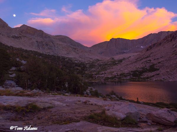
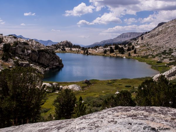
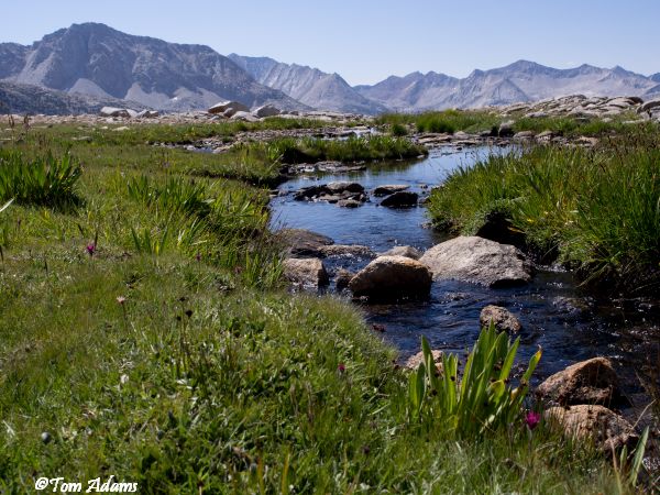
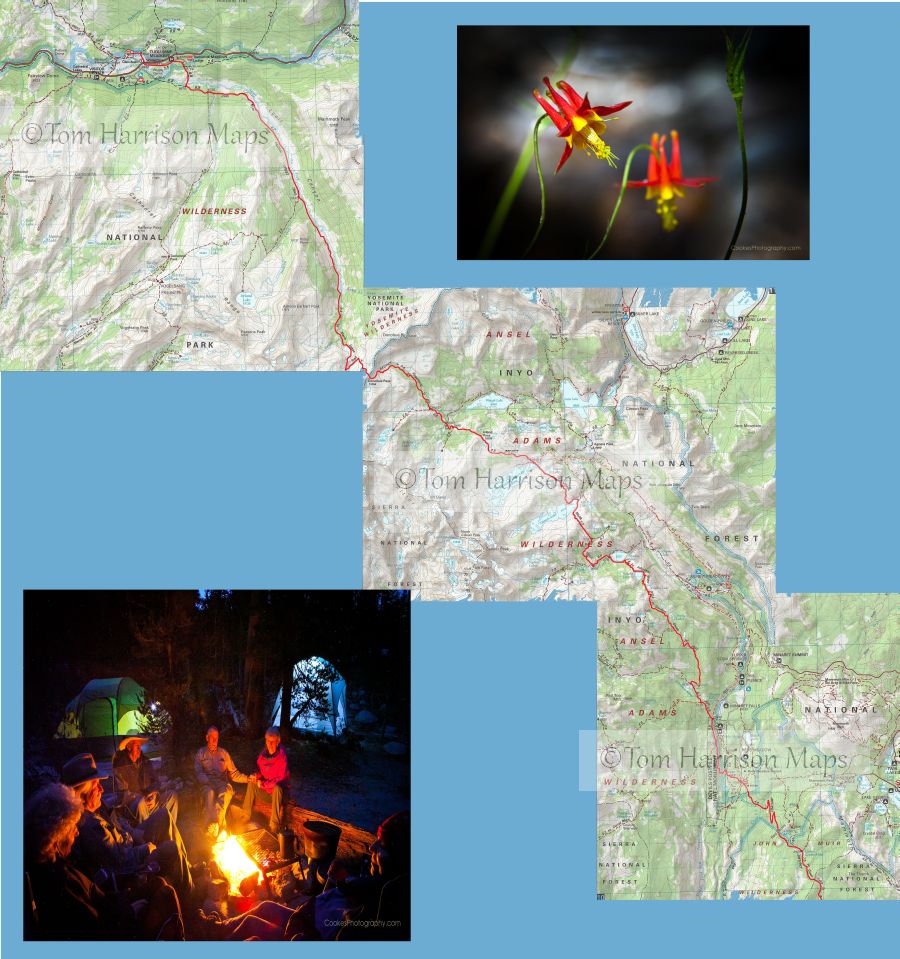
The Sierra Nevadas John Muir Trail is probably the finest wilderness route in the world. The trail skirts the peaks and high plateaus of the John Muir Wilderness, Sequoia/Kings Canyon National Parks, the Ansel Adams Wilderness and Yosemite.
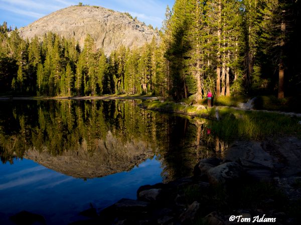
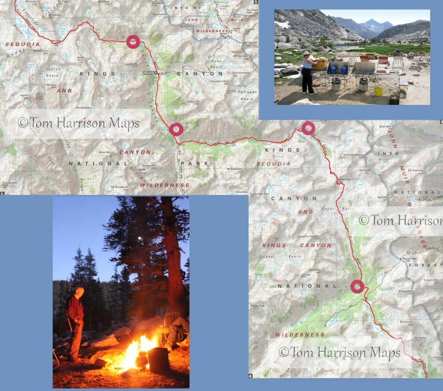
Since the 1940s, we have been packing private trips and the Sierra Club that introduced many to the wilderness. Our 28 day itinerary provides reasonable daily moves that allow you to experience the beauty of the Sierra. When possible, we enjoy the camaraderie of sitting by the fire and sharing the stories of a great day in the wilderness. The packer will furnish delicious meals with a cook to handle all the kitchen chores, including cleanup. Chairs are furnished to relax in camp. In case of rain, the wranglers will put up a large tarp to sit under. A sit-down toilet will be provided at each camp with a privacy tent. Mules will carry all equipment and food except what we require during the day and carry in our day packs.
We resupply the trip four times during the trip for fresh produce and to allow you to send in clean clothes and essential items.
Hikers are free to travel at their own pace and meet up with the cook and pack train in the afternoon to set up camp. Our open trip provides the opportunity for those that cant organize their own private pack trip.
We meet the morning of August 7th at the Londons home at 6:00AM to park cars and have breakfast. The bus picks you up and transports you and your dunnage to the road head at Horseshoe Meadows. Once you arrive at Horseshoe Meadows you travel for a month in the worlds greatest wilderness.
August in the Sierra Nevada is known for great weather, clear skies and ideal mountain travel. Generations of California families have spent August in the Sierra
in years past the whole family would relocate into the Sierra.
We invite you to join us on this trip that will be one of the greatest highlights of your life.
John Muir Trail/Pacific Crest Trail Ride
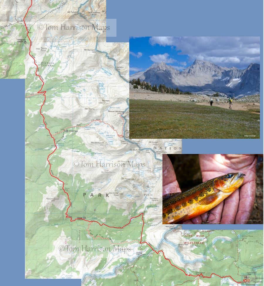
Horseshoe Meadows to Tuolumne
Daily Itinerary for 2017 John Muir/Pacific Crest Trail Ride
28 Days
Please note that this represents the planned itinerary. Weather or other factors may affect the choice of campsites and daily travel. All decisions are made by the Head Packer with attention to the safety and comfort of guests and stock.
Day 1: Meet in Bishop at 245 Rocking K Road at 6am for breakfast, check-in and transport to Horseshoe Meadow.
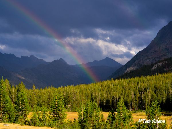
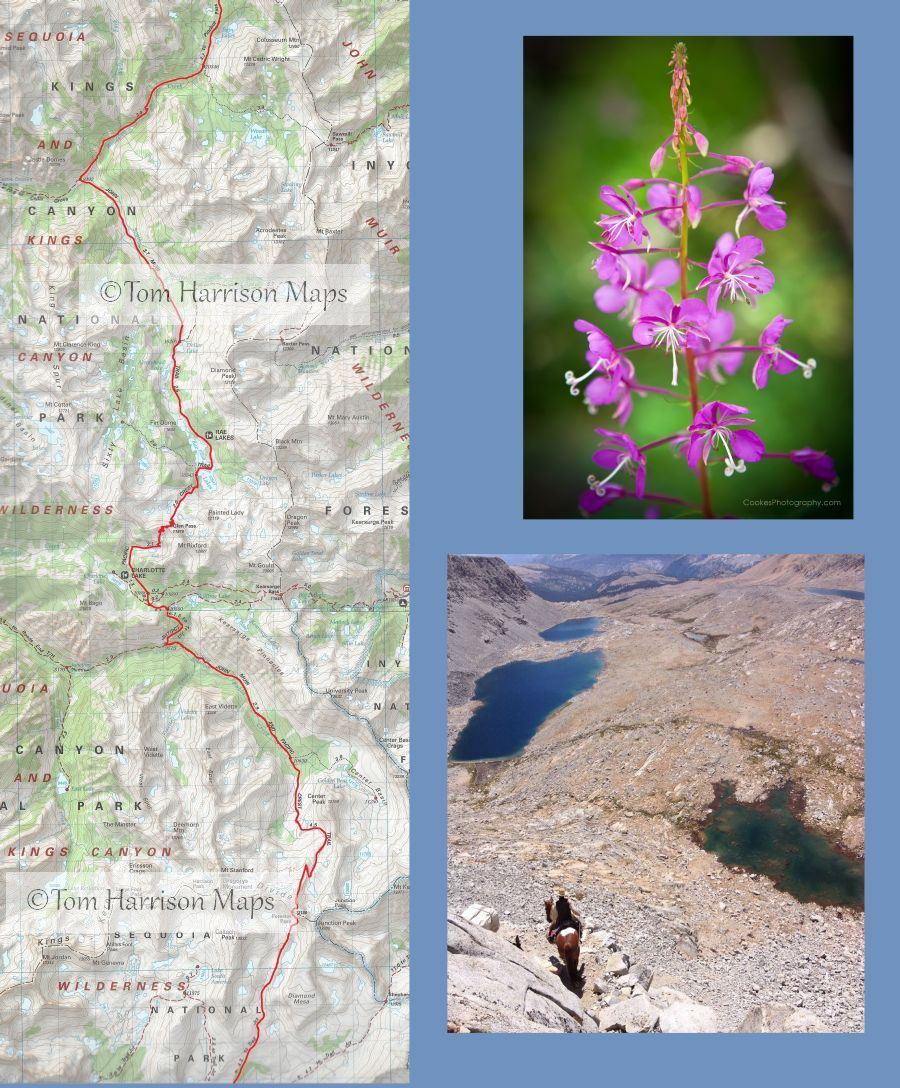
Horseshoe Meadows to Upper Rock CreekStarting at 10,000 ft. Hikers head west to climb Cottonwood Pass (11,160) and then join the PCT as it contours along the south side of Cirque Peak. The tread is sandy and there is a lot of up and down. There are spectacular views of the Golden Trout Wilderness. At the Park border, hikers head north to the headwaters of Rock Creek. Great views of the Miter Basin. Camp is at Rock Creek Lake. (11 miles)
Day 2: Rock Creek Lake to Crabtree Meadows - Head down canyon to meet the PCT. Hike north on the PCT to climb over Guyot Pass (10,900). We descend to make camp in Crabtree Meadows. (10 miles)
Day 3: Layover Opportunity to climb Mt. Whitney from the west side. Or, take a short hike to Crabtree Lakes. (15 to 16 miles roundtrip to top)
Day 4: Crabtree Meadows to Tyndal Creek-Travel north to the Wallace Creek junction where we climb a few hundred feet to the Wright Creek Basin. As we head north on the Bighorn Plateau there is a magnificent overlook of the entire Kern River Basin. Camp is at the Frog Ponds near the jct of the Shepherd Pass Trail. (8-9 miles)
Day 5: Tyndal Creek to Upper Bubbs Creek Hiking north through the high meadows of the Upper Kern we approach the southside of the cliffs. Switchback up a gradual well maintained trail to reach the top of Foresters Pass (13,200ft). This is the highest pass on the Pacific Crest Trail. Magnificent views north to the Palisades. And looking back to the south, view the 14,000 peaks north of Mt. Whitney. And, looking to the west you see the Great Western Divide and the Kaweah Peaks. Hikers head down to Bubbs Creek and make camp beneath Center Basin. (9-10 miles)
Day 6: Upper Bubbs Creek to Charlotte Lake- This is a leisurely day as it is only a few miles to Lower Vidette. After a few miles climb
we descend to Charlotte Lake for the night. (7-8 miles)
Day 7: Layover The packer heads out for the resupply. Good day for a rest or enjoying the meadows beneath Charlotte Dome.
Day 8: Charlotte Lake to Baxter Creek Ascend to the top of Glenn Pass (11,980) and descend to the Rae Lakes. Vistas of Finn Dome and the multiple lakes are considered amongst the most beautiful in the Sierra. Hikers head north to camp at Baxter Meadow. (10 miles)
Day 9: Baxter Creek to Woods Creek A gradual hike through meadows and aspens brings hikers to the crossing where the JMT cuts west and up to the jct of the Sawmill Pass Trail. Camp at the 10,000 ft level and have a campfire or head up canyon near the junction of the Twin Lakes. (6-7 miles)
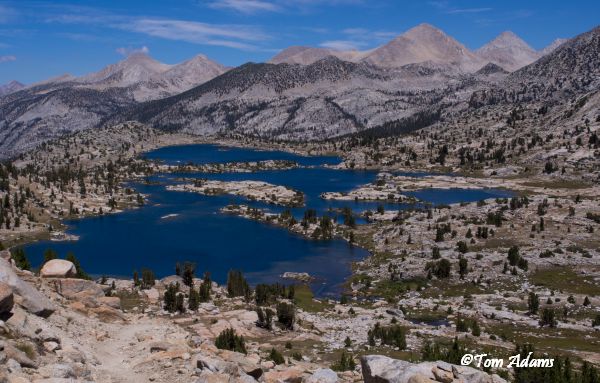
Day 10: Woods Creek to the South Fork of the Kings - Travel a few miles to the top of Pinchot Pass (12,100ft). Descend past numerous lakes and stunning views as we make camp near Little Joe Lake at the junction of the JMT and Taboose Pass Trail. (8 miles)
Day 11: Layover Explore the Bench Lake area. (Resupply day)
Day 12: South Fork of the Kings to Lower Palisade Lake Traveling north through the Upper Basin
we reach Mather Pass (12,080). We camp at Lower Palisade Lakes for the night. (9 miles
Day 13: Lower Palisade Lake to Grouse Meadow We climb down the Golden Stairway to reach Deer Meadow. The trail is through forest and meadows as we reach the campsite near Grouse Meadow. (9 miles)
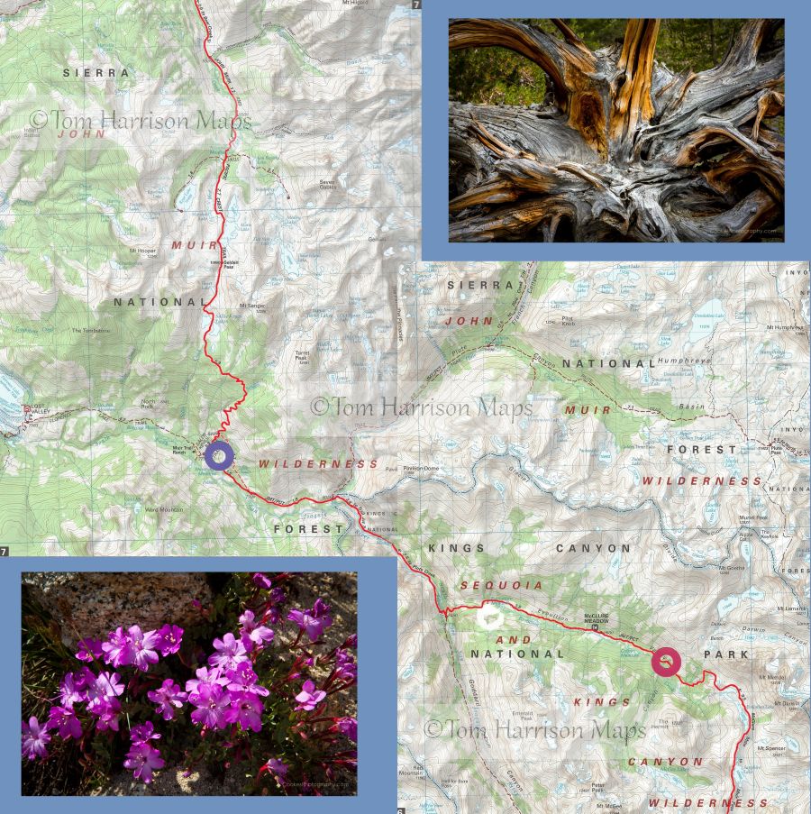
Day 14: Grouse Meadow to Big Pete/Upper Le Conte A leisurely day through the meadows of LeConte to locate camp closer to Muir Pass. (6 to 7 miles)
Day 15: Upper Le Conte to Colby Meadows We climb about 2,000 ft to reach Muir Pass(11,955). We wind down past the Evolution Lakes to make camp at Colby Meadow. (12-14 miles)
Day 16: Layover A great day to explore Evolution Valley and take a day hike up McGee Canyon .
Day 17: Colby Mdw to the San Joaquin River and JMT An easy hike along the San Joaquin River past McClure and Evolution Meadows to descend to a streamside camp. Great pools for swimming
.or head to the hot pools.(Re-supply) (9 miles)
Day 18: San Joaquin River to Bear Creek near Rose-Marie Meadows - It is a long climb up the hill to Senger Creek. The trail alternates going through meadows and forests before approaching Sally Keyes Lakes. At the top of Selden Pass (10,782) we look north to headwaters of the North Fork of the San Joaquin and the passes into Yosemite. Spectacular views as we descend past Marie Lakes to a camp near Rose-Marie Meadows. (10-12 miles)
Day 19: Layover Few locations offer such a variety of day hikes. Hike to the top of Seven Gables or take a leisurely stroll to Lou Beverly.
Day 20: Bear Creek to Quail Meadows Following Bear Creek hikers make a gradual ascent of Bear Ridge. Acres and acres of wildflowers with spectacular view of Seven Gables make it one of the most enjoyable hikes of the trip. From the top of Bear Ridge hikers head down the heavily forested north face into Quail Meadows. (10 miles)
Day 21: Quail Meadow to Horse Heaven -
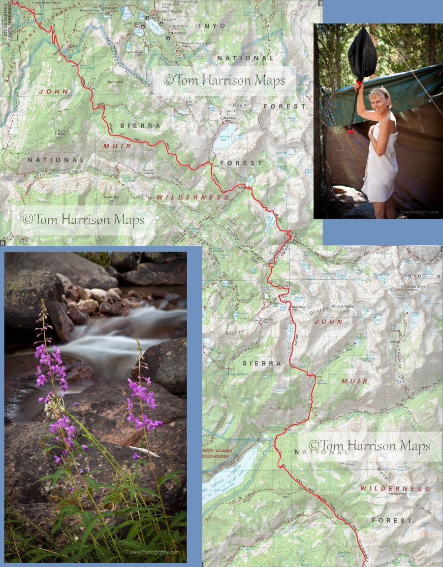
Head north on the John Muir Trail (Pacific Crest Trail) to climb towards Silver Pass. The trail skirts the edge of Pocket Meadow before heading up beneath the waterfall of the North Fork of Mono Creek. Continue north on the Muir Trail past Silver Pass Lake to reach Silver Pass. (10,900). To the south, view Seven Gables Mt. (13,075) a grand peak overlooking Bear Creek. To the northwest, see Mt. Ritter and Banner Peak and the edge of Yosemite. Descend to the head of Cascade Valley after passing the five lakes in the basin of the lakes of the Lone Indian. Riders cross the Fish Creek Bridge before following the Muir Trail a short ways to Tully Hole and Horse Heaven. (12 miles)
Day 22: Layover -
A good day to rest and fish, or take a hike up the McGee Pass Trail. Explore the lakes and streams of Upper Fish Creek beneath Red Slate Mt. (13,163) and Red and White Mountain (12,850).
Day 23: Tully Hole to Deer Creek - Hikers skirt the peaks of the Mammoth divide while trekking north alongside the rim of Fish Creek Canyon. Lake Virginia (10,300) and Purple Lake (9,900) are two beautiful lakes next to the trail. After meeting the trail to Duck Lake, continue several hours more to reach a heavily forested camp on Deer Creek (9,200). (12 to 13 miles)
Day 24: Deer Creek to Johnston Lake (Resupply comes in at Reds Meadow) - We make good time descending into Reds Meadow (7,500). Hike through Devils Postpile National Monument. These cliffs of crystallized columns of basalt are right next to the middle fork of the San Joaquin River. After crossing the river, the trail ascends alongside Minaret Creek to Johnston Lake (8,150). ( 9 miles)
Day 25: Johnston Lake to Thousand Island Lake -
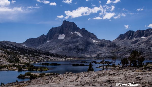
Hikers pass Rosalie Lake, Shadow and Garnet Lakes.. This is the most spectacular part of the Ansel Adams Wilderness beneath Ritter, Banner and The Minarets. We make camp on the northwest side of Thousand Island Lake (9,850). (14 miles)**We may stop at a camp mid-way depending on groups hiking ability.
Day 26: Thousand Island Lake to Upper Rush Creek - Hikers head north over Island Pass to the Rush Creek drainage. For those wanting more
take a side trip to Davis Lake or Marie Lake.6 miles)
Day 27: Upper Rush Creek to Lyell Fork Canyon - A short climb brings us to Donohue Pass (11,152). This marks the entrance to Yosemite National Park. The views of Mt. Lyell and its glacier are in view as we descend to expansive meadows in Lyell Fork Canyon. (8 miles)
Day 28: Lyell Fork Canyon to Tuolomne Meadows - Amble along through large meadows to end the trip at one of the most spectacular large meadows in the Sierra
Tuolomne Meadows. (7 miles) Guests meet the vans to head to Bishop.
What you need to know
for hikers on pack stock supported trips
Dunnage limit is 30 lbs. per person (this includes sleeping bags, fishing equipment, liquor, etc.)
You may bring your own tent up to 10 pounds that is in addition. The PCT 28 day trip allows 35 pounds of duffel.
PERSONAL CHECK LIST
Bring belongings in stout canvas or nylon duffels; side zipper recommended, ideal size approximately 14" x 32". It is a good idea to use a large plastic bag INSIDE of the duffle to protect contents from external moisture.
Sleeping bags can be in separate duffels --again, line the inside of the duffle against rain.
Place all cosmetics, soaps, medications, etc into small plastic containers with close-fitting caps, THEN into sturdy resealable plastic storage bags. If anything breaks or bursts from altitude changes, the plastic bag contains the spill.
When possible, it is a good idea to transfer alcoholic beverages to sturdy plastic bottles with well fitting caps - it will save weight and protect against breakage.
ESSENTIALS
- Footwear. For this trips a medium-weight pair of hiking boots. We
do not recommend lightweight hikers or tennies since they give
little ankle support and the soles are often thin.
- Camp Shoes. A lightweight pair of tennies or Tevas to wear in
camp. This will reduce vegetation damage at our campsites.
- A day pack. It should be large enough to take water, extra clothing, rainwear,
camera, etc during the days.
- Sleeping Bag. Most summer trips are warm and a bag rated to
about 25°F will be plenty warm enough. We much prefer down
bags, and good quality ones at that. Your bag should weigh in
around 3 pounds.
- Sleeping pad. A 3/4 or full length closed cell foam or Thermarest.
If you bring a Thermarest also bring a repair kit to fix pesky holes!
- Coffee mug (plastic for camp)
CLOTHING
- 2 pair synthetic liner socks.
- 2 pair heavier synthetic or wool blend socks.
- Long underwear top. Capilene, some other synthetic or the new
pure Merino wool types.
- Long underwear bottom.
- Warm pants. Tights or Expedition Weight Capilene.
- Warm shirt. Synchilla or R2 weight works well.
- Another fuzzy sweater top or pile jacket of some sort
- GoreTex Jacket and Pants. A lightweight set is sufficient and heavy
bulky clothing is unnecessary. Side zips on the pants should be
long enough to slide over boots. Jacket must have a hood. Do not
skimp on your rain gear. Nylon ponchos are not acceptable.
- Shorts for on the trail
- Tee shirt for on the trail
- Lightweight capilene or similar gloves.
- Warm hat. Synthetic or wool.
- Sunhat
ETC.
- Sun glasses.
- Water Bottles. Two quart (1 liter) wide mouth bottles and/or a hydration
system holding up to 50oz. (2 liters). Dont bring bike bottles or
any bottle that doesnt have a wide opening.
- Headlamp. --and a spare set of batteries!
- Pocket knife. Swiss army style.
- Personal toiletries. It is not necessary to smell like a rose each day
so do not over do it.
- Ear plugs are great to have in a noisy tent.
- Personal Medical Kit. The guide will carry a large kit so yours will
predominately consist of foot repair items, mild pain killer such as
Advil and bandaids.
- Sunscreen and lip screen. SPF 30+. A 1oz. bottle will be enough.
Make sure the lip stuff actually contains a sunscreen.
- Bug repellent.
- Camera. A spare battery and card are good backups
- Ski/trekking poles. These are not essential, but can be handy on
the trail. It is your choice, but they do save wear on the knees.
- Plastic trash bag. Handy for keeping gear in outside the tent
should it rain.
- Optional reading material, etc.
FOOD
We provide the all meals on scheduled trips. You can bring
your favorite "on-the-trail" snacks.
OPTIONAL ITEMS
- Small notepad and pencil
- Collapsible plastic wash basin (optional)
- Solar shower (optional)
- Water filtering pump (optional)
- Liquor (be sure to check in with the packers to see that your liquor is packed safely)
- Fishing equipment (optional)
- Rod/reel/line (a rod that breaks down into 3 or more pieces is recommended)
- Compact metal rod case to carry on saddle
- Canvas creel (no tackle boxes)
- Leader material (1-3 lb.)
- Flies: black gnat, mosquito, grey hackle, brown hackle, & royal coachman (No. 12-14 hooks)
- Bait: worms & Pautzke red eggs
- Egg hooks, worm hooks (No. 10-14)
- Split shot
- Lures (personal choice)
- Pliers